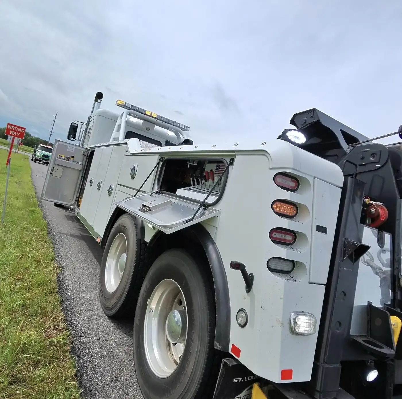
Towing, recovery and truck repair across Johnson County, Kansas
Titan Tow & Repair tows heavy, medium and light-duty vehicles across Johnson County, Kansas, 24 hours a day, dispatched from our yard in Liberty, Missouri. We cover Olathe, the county seat, I-35 down through Gardner, the I-435 loop and K-10 through De Soto, with winch-outs, recovery, and roadside repair for trucks, trailers and tires.
Johnson County runs on a grid, with a road every mile, and the highways cut across it. I-35 runs diagonally from near downtown Kansas City through Olathe and Gardner. The north–south leg of I-435 marks the edge of the built-up suburbs, and its east–west leg divides the older northern cities from the growing south. US-69 enters from Wyandotte County at the south end of I-635 and carries on south as a freeway, while US-56 and US-169 share I-35 along the north-west edge of Overland Park before turning east as Shawnee Mission Parkway. K-7 and K-10 serve the west side. The Kansas River forms part of the north-west county line, and the bridge at De Soto is the county's only road link to Leavenworth County.
Freight gathers in a few places: the intermodal yard and warehouses at Edgerton, New Century AirCenter and Olathe's industrial parks, and the old Sunflower Army Ammunition Plant ground south of De Soto, renamed Astra Enterprise Park for redevelopment. The north-east corner is the opposite: a cluster of small cities along the Kansas City, Missouri line, many of them sharing the Shawnee Mission mailing name. In the rural south-west, Bull Creek and Little Bull Creek drain toward Hillsdale Lake. When you call, give the city first, then a numbered street and a named road from the grid. Together they pin you to one corner.
Olathe is the county seat, tied to Kansas City by I-35 in the 1950s and grown out over the farm fields since. BNSF's Chicago–Los Angeles main line runs through it, and its industrial parks and New Century AirCenter keep trucks moving between docks, gates and the K-7 and I-35 interchange. Lake Olathe and Cedar Lake are its two public lakes.
Overland Park runs nearly the full north–south length of the county. I-435 and US-50 share the road east to west across the city, US-69 runs north–south through it, and Metcalf Avenue carries on north out of the city as I-635. BNSF tracks follow I-35 along the north-west edge. Pair a numbered street with a named road, such as 159th Street and Metcalf.
Shawnee stretches from the Kansas River, where Mill Creek flows in, up to K-7 on its western edge, and I-435 climbs through it away from the river. Johnson Drive and Shawnee Mission Parkway carry the local delivery and service traffic. Shawnee Mission Park and its lake lie inside the city, as does the Shawnee Town 1929 museum.
Lenexa holds the Kansas-side crossing of I-35 and I-435, and the warehouse belt around that interchange is dock country. K-10 heads west from the city toward De Soto and Lawrence. Away from the docks, Lenexa City Center, with its hospital and library branch, and the National Archives records center known as the Caves are landmarks worth naming.
Leawood is long and narrow, running down the Missouri state line with Prairie Village at its north end and Overland Park wrapped around its west and south sides. Indian Creek and Tomahawk Creek meet inside the city before crossing into Missouri. Town Center Plaza and the main campus of the Church of the Resurrection are its big destinations, and Lee Boulevard was built under Oscar G. Lee, the landowner the city is named for. Leawood's own police work its streets; the Kansas Highway Patrol rarely does.
Gardner grew up where the Santa Fe Trail split from the Oregon and California trails, and it is still a junction town: I-35 carries the intermodal freight bound for Edgerton past it, and US-56 runs through the middle. Kill Creek rises here. Gardner Lake, on the north side off South Gardner Road and 151st Street, is the landmark to give away from the interstate.
Prairie Village is the suburb J.C. Nichols built in the 1940s on farmland bought from the Porter, Coppock and Lewis families, named for the old Prairie School. Its commercial anchors are the Prairie Village Shopping Center and Corinth Square, and Homestead Country Club occupies the former Coppock land. Brush Creek flows east-north-east through the city toward Mission Hills, and remnants of the Santa Fe Trail survive inside its limits.
Merriam, KS
Merriam straddles I-35 from just south-west of the I-635 junction down to 75th Street, with Turkey Creek running alongside the interstate and Shawnee Mission Parkway nearly cutting the city in half. The IKEA store at Johnson Drive and I-35 is the easiest landmark to give, and Seaboard Corporation has its headquarters here. The city was named for an officer of the Kansas City, Fort Scott and Gulf railroad, which ran through it.
Mission, KS
Mission takes its name from an Indian mission founded on the site in 1829. It lies between Merriam on the west and Fairway on the east, with Roeland Park to the north-east and Overland Park to the south-west, and the Cumulus Media and Entercom radio studios are here. Addresses in Mission often carry the Shawnee Mission postal name, which covers several cities, so name the city itself as well as the street.
Roeland Park, KS
Roeland Park is named for John Roe, an Irish immigrant whose family home was pulled down to make room for the interchange at Roe Boulevard and Shawnee Mission Parkway. Before incorporation it was Southridge, a streetcar suburb on William Strang's interurban line from Rosedale to downtown Overland Park. The community center and pool on Rosewood Drive, Bishop Miege High School and the Cedar Roe library branch are its local reference points.
De Soto, KS
De Soto is the one Johnson County city laid out along the Kansas River, and K-10 runs through its south side with four exits: Evening Star Road, Edgerton Road, Lexington Avenue and Kill Creek Road. Lexington Avenue, formerly K-285, cuts diagonally through town and becomes West 83rd Street heading east. County Road 2 crosses the river north toward K-32. South of town, the old ammunition plant ground is the site Panasonic chose for its electric-vehicle battery plant, and an Army-built rail spur still serves the industrial district.
Spring Hill, KS
Spring Hill grew on the old route between Olathe and Paola and now spreads across the Johnson–Miami county line, so a call here can fall in either county. When the railroad came it laid its tracks east of the first town square, and the business district moved over to the depot. US-169 serves the town. In 2019 the Kansas City Star reported it growing faster than any other city in the metro, which means new streets and subdivisions, so give a cross street along with the neighborhood name.
Fairway, KS
Fairway took its name from the golf driving ranges near the subdivision J.C. Nichols laid out here in the 1930s, and it is known as the City of Trees. Its landmark is the Shawnee Methodist Mission, the old Shawnee Indian Manual Labor School, now a National Historic Landmark that the city operates as a museum. Fairway has kept its own police force since it incorporated.
Mission Hills, KS
Mission Hills lines State Line Road on the Kansas side, and 63rd Street splits it in two: the older north half holds the Mission Hills and Kansas City country clubs, the southern half the Indian Hills Country Club. Brush Creek cuts through the north end. Its landmark is the Verona columns and reflecting pool where Ensley Lane, Mission Drive and Overhill Road meet, a useful reference on Nichols-era streets that curve rather than follow the grid.
Westwood, KS
Westwood is boxed in by 47th Street on the north, Shawnee Mission Parkway on the south, Mission Road on the west and Rainbow Boulevard on the east, with a strip that reaches past Rainbow to State Line Road. It borrowed its name from the Westwood neighborhood just over the line in Missouri, so make clear you mean Westwood, Kansas. The city runs its own police department.
Edgerton, KS
Edgerton, south-west of Gardner, began as a railroad town named for the Santa Fe railway's chief engineer, and rail still shapes it. BNSF's intermodal yard, Logistics Park Kansas City, opened here with a warehouse park beside it, and BNSF also built a refueling plant in town. The traffic is containers, chassis and trailers moving between the yard, the warehouses and I-35 at Gardner. The Johnson County Sheriff's Office patrols the town.
Lake Quivira, KS
Lake Quivira is a small lake community that straddles the Johnson–Wyandotte county line, north of Shawnee and south-east of Edwardsville. It began in the 1920s as a subdivision built on an artificial lake, and the city keeps its own police department. Give dispatch the street name and say which side of the lake you are on.
Westwood Hills, KS
Westwood Hills is a single J.C. Nichols subdivision, begun in the early 1920s, that became its own city and is now listed on the National Register of Historic Places. It borders Kansas City, Missouri, and neighboring Westwood once voted against merging with it. Its highway is US-169. Say Westwood Hills, Kansas when you call, because across the line is a different city in a different state.
Mission Woods, KS
Mission Woods is a few wooded blocks that J.C. Nichols laid out in the 1930s, named for a Native American mission that stood on the site and for the trees around it. Its highways are US-56 and US-169. It lies north of Mission Hills and north-east of Fairway, and with so many small cities close together, a street and the nearest cross street locate you better than the city name alone.
What cross streets should I give you on the Johnson County mile grid?
A numbered street and a named road. Titan Tow & Repair finds breakdowns across Johnson County on its road grid, which has a road every mile: numbered streets start at 47th Street on the Wyandotte County line and run south to 215th Street, and named roads run from State Line Road on the east to County Line Road at the Douglas County line. One of each puts us at a single corner. Add the city too, because a Shawnee Mission mailing address can belong to any of several towns.
Who can reach a truck that breaks down at a K-10 exit in De Soto?
Titan Tow & Repair can, 24 hours a day, dispatched from our yard in Liberty, Missouri. K-10 runs through the south side of De Soto with four exits: Evening Star Road, Edgerton Road, Lexington Avenue and Kill Creek Road. Tell dispatch the nearest exit, your direction, and whether you are on the highway shoulder or already up on the crossroad. A heavy wrecker takes a loaded tractor-trailer, and the mobile service truck can often fix an air leak, a dead battery or a flat where the truck stopped.
Can you pick up a car that won't start at Oak Park Mall or Town Center Plaza?
Yes, at any hour. Titan Tow & Repair sends a rollback flatbed for a car or pickup that will not start, has a tire it cannot run on, or cannot be driven after a scrape in the lot. Oak Park Mall is in Overland Park and Town Center Plaza is in Leawood; tell dispatch which store or entrance you are parked nearest and the row. Mention it if the car is all-wheel drive or sits low, because that decides how it is loaded.